 FormaTerre
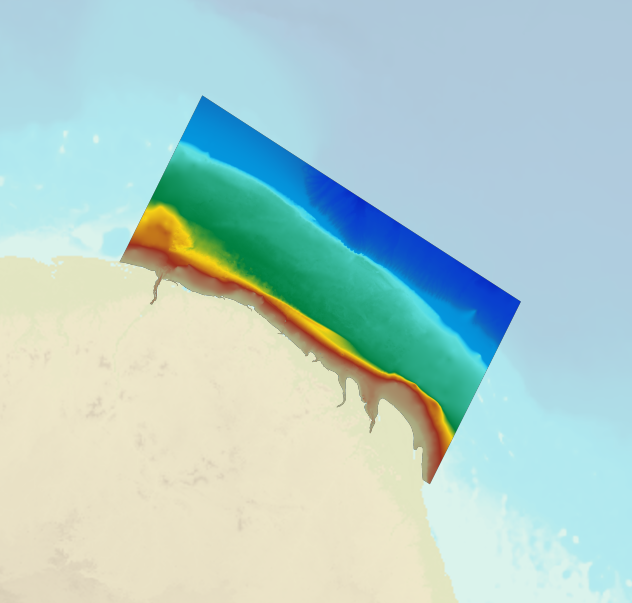
digital elevation model
Type of resources
Available actions
Topics
INSPIRE themes
Keywords
Provided by
Representation types
Update frequencies
status
-
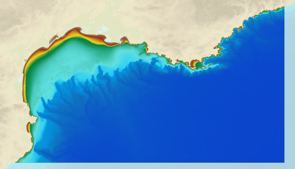
The coastal topo- bathymetric DEM for the coasts of Morbihan with a resolution of 0.0002° (~ 20 m) was prepared as part of the TANDEM project (Programme Investissements d'Avenir, ANR-11-RSNR-00023-01). It covers the French administrative department of Morbihan and part of Loire-Atlantique. This DEM runs from the Gâvres peninsula in the north west to La Baule in the south east and covers the Gulf of Morbihan, the Quiberon bay and peninsula, Houat, Hoëdic and Belle-Ile islands and the Vilaine estuary. The DEM is designed to be implemented in the hydrodynamic models of the TANDEM project in order to estimate the coastal effects of tsunamis for the Atlantic and English Channel, where French nuclear power plants have been installed for about 30 years. This product is available with the Lowest Astronomic Tide (LAT) or the Mean Sea Level (MSL) as a vertical datum.
-
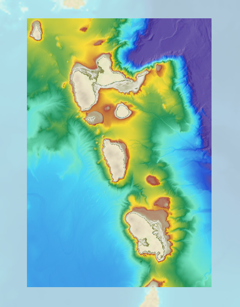
The bathymetric DEM for the coasts of Guadeloupe and Martinique with a resolution of 0.001° (~ 100 m) was prepared as part of the HOMONIM project. The DEM covers some of the Lesser Antilles islands, from Montserrat in the north to Sainte-Lucie in the south. The model ranges off-shore to a depth of 5800 m. The DEM is designed to be used in hydrodynamic models in order to produce high-precision forecasts for coastal water levels and sea conditions and therefore improve the pertinence of the Waves-Submersion monitoring programme.
-

The bathymetric DEM for the coasts of Guadeloupe and Martinique with a resolution of 0.001° (~ 100 m) was prepared as part of the HOMONIM project. The DEM covers some of the Lesser Antilles islands, from Anguilla in the north to Saba in the south. The model ranges off-shore to a depth of 3275 m. The DEM is designed to be used in hydrodynamic models in order to produce high-precision forecasts for coastal water levels and sea conditions and therefore improve the pertinence of the Waves-Submersion monitoring programme.
-
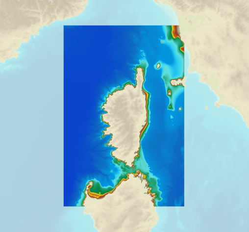
The bathymetric DEM for the coasts of Corsica with a resolution of 0.001° (~ 100 m) was prepared as part of the HOMONIM project. It covers the entire Corsican margin. The model ranges off-shore to a depth of 3000 m. The DEM is designed to be used in hydrodynamic models in order to produce high-precision forecasts for coastal water levels and sea conditions and therefore improve the pertinence of the Waves-Submersion monitoring programme. This product is available with the Lowest Astronomic Tide (LAT) or the Mean Sea Level (MSL) as a vertical datum.
-

The bathymetric DEM for the coasts of New-Caledonia with a resolution of 0.001° (~ 100 m) was prepared in the framework of a Shom-IRD partnership as part of the TSUCAL project. The DEM covers the basin from New Caledonia in the west to the Vanuatu archipelago in the east. The DEM is designed to be used in hydrodynamic models in order to improve the pertinence of the Waves-Submersion monitoring programme.
-

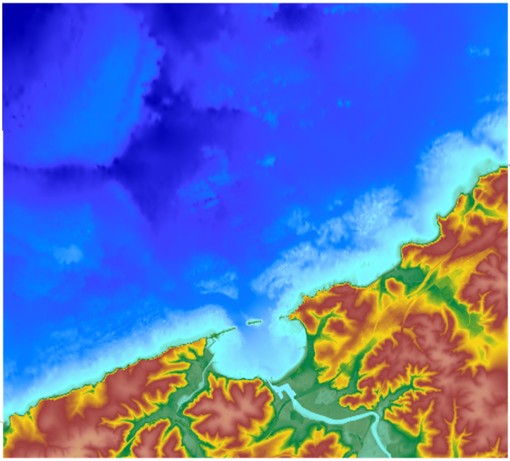
The coastal topo-bathymetric DTM of the Arcachon basin and its surroundings at a resolution of 0.0002° (~ 20 m) was produced as part of the HOMONIM project. The DTM covers the coastline of a part of the Gironde department, from the Carcans and Hourtin ponds in the North, to the Cazaux and Sanguinet lakes in the South. It covers the entire Arcachon basin and extends offshore to about 40 m depth. The DTM is intended to be implemented in hydrodynamic models in order to produce accurate forecasts of water heights and sea states at the coast and to improve the French storm surge warning system. This product is available with the Lowest Astronomic Tide (LAT) or with the Mean Sea Level (MSL) as a vertical datum.
-
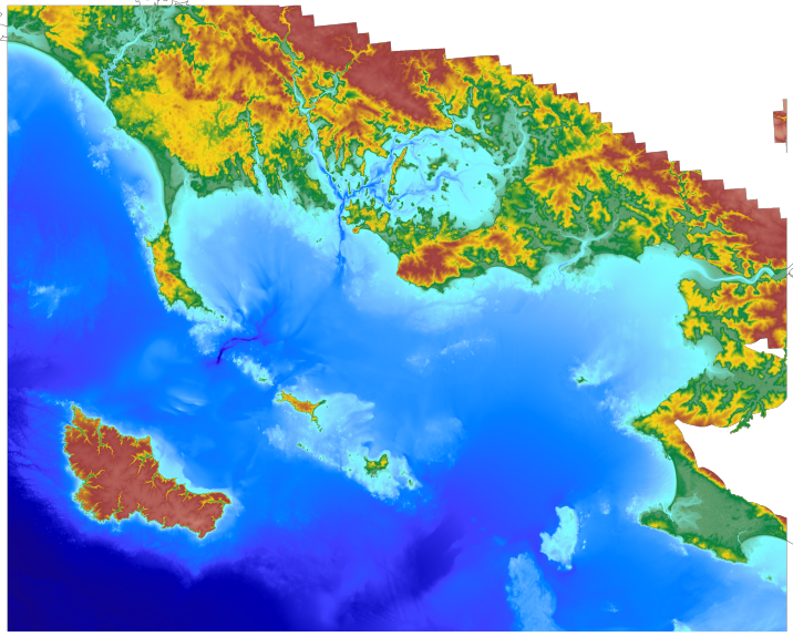
The coastal topo- bathymetric DEM for the coasts of the straight of Pas-de-Calais with a resolution of 0.0002° (~ 20 m) was prepared as part of the TANDEM project. The DEM covers the eastern Channel and southern North Sea, including the French coast of the Nord - Pas-de-Calais administrative department and part of the British coast, in the county of Kent, and the south part of the Thames estuary up to Rye. The DEM is designed to be implemented in the hydrodynamic models of the TANDEM project in order to estimate the coastal effects of tsunamis for the Atlantic and English Channel, where French nuclear power plants have been installed for about 30 years. This product is available with the Lowest Astronomic Tide (LAT) or the Mean Sea Level (MSL) as a vertical datum.
-
The bathymetric DEM for the coasts of French Guiana with a resolution of 0.001° (~ 100 m) was prepared as part of the HOMONIM project. The DEM covers the entire Guyanese coast and part of Surinam to the west and Brazil to the east. Off-shore, the DEM covers the continental shelf and part of the slope. The DEM is designed to be used in hydrodynamic models in order to produce high-precision forecasts for coastal water levels and sea conditions and therefore improve the pertinence of the Waves-Submersion monitoring programme. This product is available with the Lowest Astronomic Tide (LAT) or the Mean Sea Level (MSL) as a vertical datum.
-
A bathymetric DEM for the coasts of Gulf of Lion – Côte d’Azur with a resolution of 0.001° (~ 100 m) was prepared as part of the HOMONIM project. It covers the entire Mediterranean metropolitan facade. The model ranges off-shore to a depth of 2800 m. The DEM is designed to be used in hydrodynamic models in order to produce high-precision forecasts for coastal water levels and sea conditions and therefore improve the pertinence of the Waves-Submersion monitoring programme. This product is available with the Lowest Astronomic Tide (LAT) or the Mean Sea Level (MSL) as a vertical datum.
-
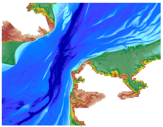
The coastal topo- bathymetric DEM for the coasts of the Saint-Jean-de-Luz bay with a resolution of 0.0002° (~ 20 m) was prepared as part of the TANDEM project. It covers Saint-Jean-de-Luz bay and the surrounding area. The DEM is designed to be implemented in the hydrodynamic models of the TANDEM project in order to estimate the coastal effects of tsunamis for the Atlantic and English Channel, where French nuclear power plants have been installed for about 30 years. This product is available with the Lowest Astronomic Tide (LAT) or the Mean Sea Level (MSL) as a vertical datum.