 FormaTerre
Volcanology
Type of resources
Topics
Keywords
Contact for the resource
Provided by
Formats
Representation types
Update frequencies
status
-
Three types of products are made available for each orbit portion processed (see <a href="https://formater.pages.in2p3.fr/flatsim/" target="_blank"> detailed description </a> ) - "INTERFEROGRAM": this brings together the differential interferograms, wound and unwound, in radar or terrain geometry, filtered or not, at different resolutions, as well as the atmospheric correction maps used and spatial coherence for each interferogram. - "TIMESERIES": this includes maps of movement in time series and average speed, according to the satellite line of sight (LOS), and quality indices of time series processing. - "AUXILIARYDATA": this directory contains maps indicating the LOS vector, the DTM in radar geometry, at different resolutions, the radar-field geometry transcoding tables, and temporal coherence, as well as a set of figures and parameter files specific to the processing of the time series.
-
BD content description
-
Three types of products are made available for each orbit portion processed (see <a href="https://formater.pages.in2p3.fr/flatsim/" target="_blank"> detailed description </a> ) - "INTERFEROGRAM": this brings together the differential interferograms, wound and unwound, in radar or terrain geometry, filtered or not, at different resolutions, as well as the atmospheric correction maps used and spatial coherence for each interferogram. - "TIMESERIES": this includes maps of movement in time series and average speed, according to the satellite line of sight (LOS), and quality indices of time series processing. - "AUXILIARYDATA": this directory contains maps indicating the LOS vector, the DTM in radar geometry, at different resolutions, the radar-field geometry transcoding tables, and temporal coherence, as well as a set of figures and parameter files specific to the processing of the time series.
-
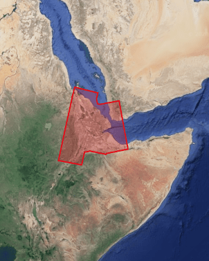
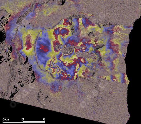
This project aims to characterize the spatial and temporal distribution of the deformation in the region of the Afar depression. The aim is to better understand large-scale tectonics (localization of divergent borders, kinematics of the triple point), but also the dynamics of volcanic, seismic and aseismic events, and the mechanics of active faults. The issue of gravity hazard will also be addressed. Three types of products are made available for each orbit portion processed (see <a href="https://formater.pages.in2p3.fr/flatsim/" target="_blank"> detailed description </a> ) - "INTERFEROGRAM": this brings together the differential interferograms, wound and unwound, in radar or terrain geometry, filtered or not, at different resolutions, as well as the atmospheric correction maps used and spatial coherence for each interferogram. - "TIMESERIES": this includes maps of movement in time series and average speed, according to the satellite line of sight (LOS), and quality indices of time series processing. - "AUXILIARYDATA": this directory contains maps indicating the LOS vector, the DTM in radar geometry, at different resolutions, the radar-field geometry transcoding tables, and temporal coherence, as well as a set of figures and parameter files specific to the processing of the time series.
-
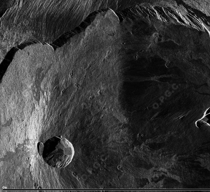
This collection includes radar images acquired by the sensor TerraSAR-X (monostatic) over Merapi volcano (Indonésie) in the framework of the projects DLR « Study of dome growth and summit topographic changes at andesitic strato-volcanoes» (OTHER6947) and « Tracking of dome growth at Merapi volcano, Indonesia » (XTIGEOL7375) . The data format is SSC (Single Look Slant Range Complex). The acquisition mode is stripMap (SM) for two ascending track A20 and A96 and one descending track D134.
-
This collection includes radar images acquired by the sensor PAZ (monostatic) over Merapi volcano (Indonésie) in the framework of the project (AO-003-022) «Characterization of erupted volumes and ground deformation signals over Indonesian active volcanoes ». The data format is SSC (Single Look Slant Range Complex) with the acquisition mode High-resolution SpotLight (HS) for the descending tracks D020 and D111.
-
This collection includes radar images acquired by the sensor TerraSAR-X (monostatic) over Merapi volcano (Indonésie) in the framework of the project DLR (GEO1598) « Study of andesitic strato-volcanoes topographic changes and deformation through high-resolution SAR imagery ». The data format is SSC (Single Look Slant Range Complex). There are two acquisition modes: - mode StripMap (SM) for ascending track A20 and descending track D134. - mode SpotLight (SL) for ascending track A96 and descending track D58.
-
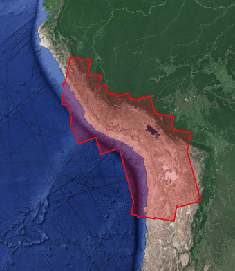
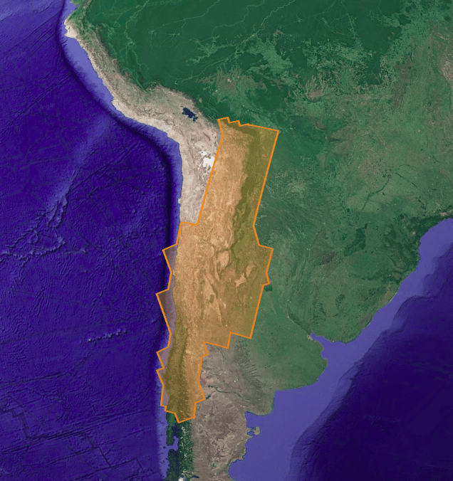
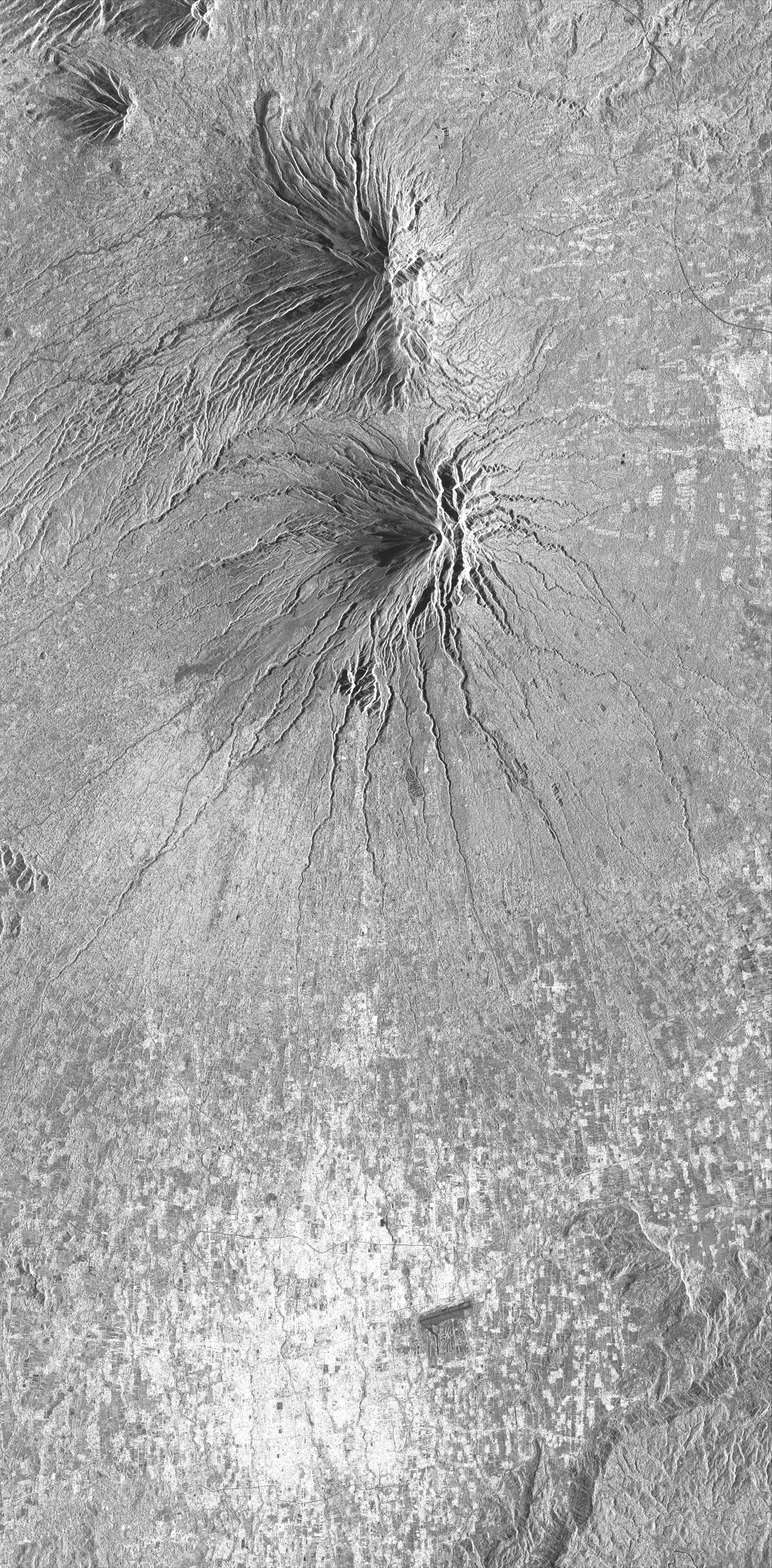
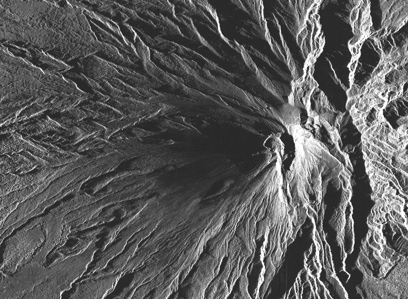
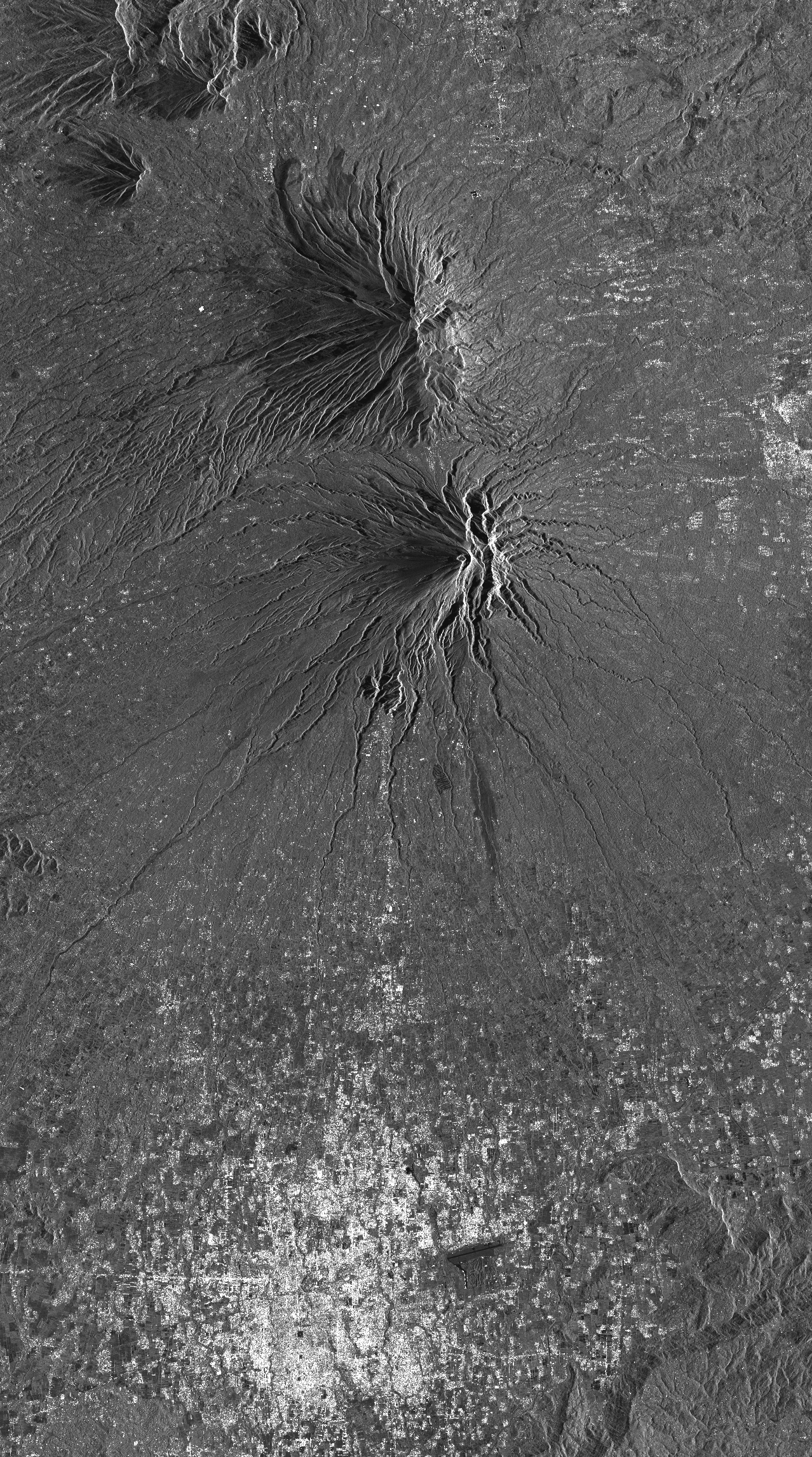
This project aims to better understand the seismic cycle of the Andean subduction zone in Peru and Chile and the crustal faults in the Andes, to follow the functioning of the large active volcanoes in the region (and to detect possible precursors to eruptions) , and to study the seismic, climatic and anthropogenic forcing on the dynamics of landslides in the Andes. Three types of products are made available for each orbit portion processed (see <a href="https://formater.pages.in2p3.fr/flatsim/" target="_blank"> detailed description </a> ) - "INTERFEROGRAM": this brings together the differential interferograms, wound and unwound, in radar or terrain geometry, filtered or not, at different resolutions, as well as the atmospheric correction maps used and spatial coherence for each interferogram. - "TIMESERIES": this includes maps of movement in time series and average speed, according to the satellite line of sight (LOS), and quality indices of time series processing. - "AUXILIARYDATA": this directory contains maps indicating the LOS vector, the DTM in radar geometry, at different resolutions, the radar-field geometry transcoding tables, and temporal coherence, as well as a set of figures and parameter files specific to the processing of the time series.
-
BD content description
-
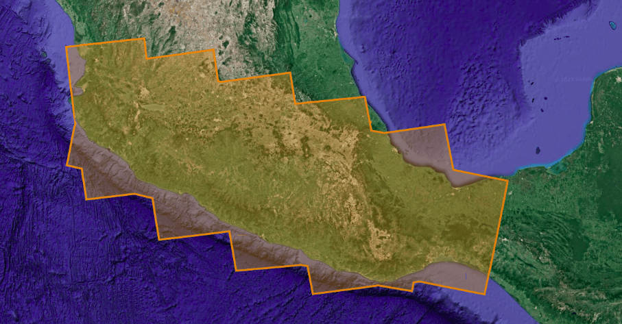
This collection includes radar images acquired by the TerraSAR-X / TanDEM-X constellation over Montagne Pelée (Martinique). Images are in SSC format (Single Look Slant Range Complex). Acquisition mode is either SPT (Spotlight) or SM (Stripmap). Tracks are either o104 (ascending track) or o020 (descending track).