 FormaTerre
Glacier
Type of resources
Topics
Keywords
Contact for the resource
Provided by
Formats
Representation types
Update frequencies
status
-
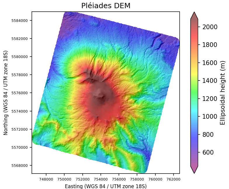
The Pléiades Glacier Observatory (PGO) dataset collection is an initiative of the French Space Agency / CNES, of the Laboratory of Space Geophysical and Oceanographic Studies / LEGOS and of Institut National des Sciences de l'Univers / CNRS-INSU to facilitate access to Pléiades satellite stereo-imagery over glacier targets. The collection consists in Very-High Resolution (0.5m) Digital Surface Models (DSMs) and ortho-images for the glaciology community.
-
Three types of products are made available for each orbit portion processed (see <a href="https://formater.pages.in2p3.fr/flatsim/" target="_blank"> detailed description </a> ) - "INTERFEROGRAM": this brings together the differential interferograms, wound and unwound, in radar or terrain geometry, filtered or not, at different resolutions, as well as the atmospheric correction maps used and spatial coherence for each interferogram. - "TIMESERIES": this includes maps of movement in time series and average speed, according to the satellite line of sight (LOS), and quality indices of time series processing. - "AUXILIARYDATA": this directory contains maps indicating the LOS vector, the DTM in radar geometry, at different resolutions, the radar-field geometry transcoding tables, and temporal coherence, as well as a set of figures and parameter files specific to the processing of the time series.