 FormaTerre
Geodetics
Type of resources
Topics
Keywords
Contact for the resource
Provided by
Formats
Representation types
Update frequencies
status
-
The collection consists of a series of products (DSM, hillshades, quality maps) of interest for the Earth and environmental science community. It covers various sites and landscapes over the World. The dataset is an open collection with regular updates according to the availability of Pléiades stereo-imagery for science and/or public organizations and the generation of topographic products with the <a href="https://www.poleterresolide.fr/le- service-dsm-opt/" target="_blank">DSM-OPT on-demand service</a> . The collection is disseminated using FAIR principles under the Digital Object Identifier (DOI): doi:10.25577/0JGV-V947
-
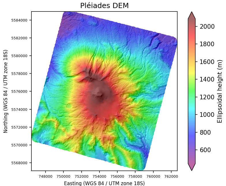
The Pléiades Glacier Observatory (PGO) dataset collection is an initiative of the French Space Agency / CNES, of the Laboratory of Space Geophysical and Oceanographic Studies / LEGOS and of Institut National des Sciences de l'Univers / CNRS-INSU to facilitate access to Pléiades satellite stereo-imagery over glacier targets. The collection consists in Very-High Resolution (0.5m) Digital Surface Models (DSMs) and ortho-images for the glaciology community.
-
Orbit and products derived from the processing of DORIS data from DORIS terrestrial network. Products are referenced to the International Terrestrial Reference Frame (ITRF). -Weekly solution for EOP and Stations coordinates in SINEX format - Daily DORIS ephemeris at 30-sec intervals
-
Orbit and auxiliary products derived from the processing of GNSS data from global terrestrial networks, used for the precise processing of data from various receivers (fixed, mobile, on-board, floating, etc.). Products are referenced to the International Terrestrial Reference Frame (ITRF). - Daily solution for EOP and Stations coordinates in SINEX format - Daily GPS, GLONASS & GALILEO ephemeris/clock at 5-min intervals - Daily GNSS ephemeris/clock at 30-sec intervals - Daily GNSS Attitude at 30-sec intervals in ORBEX format - Daily GNSS Observable Specific Biases
-
BD content description
-
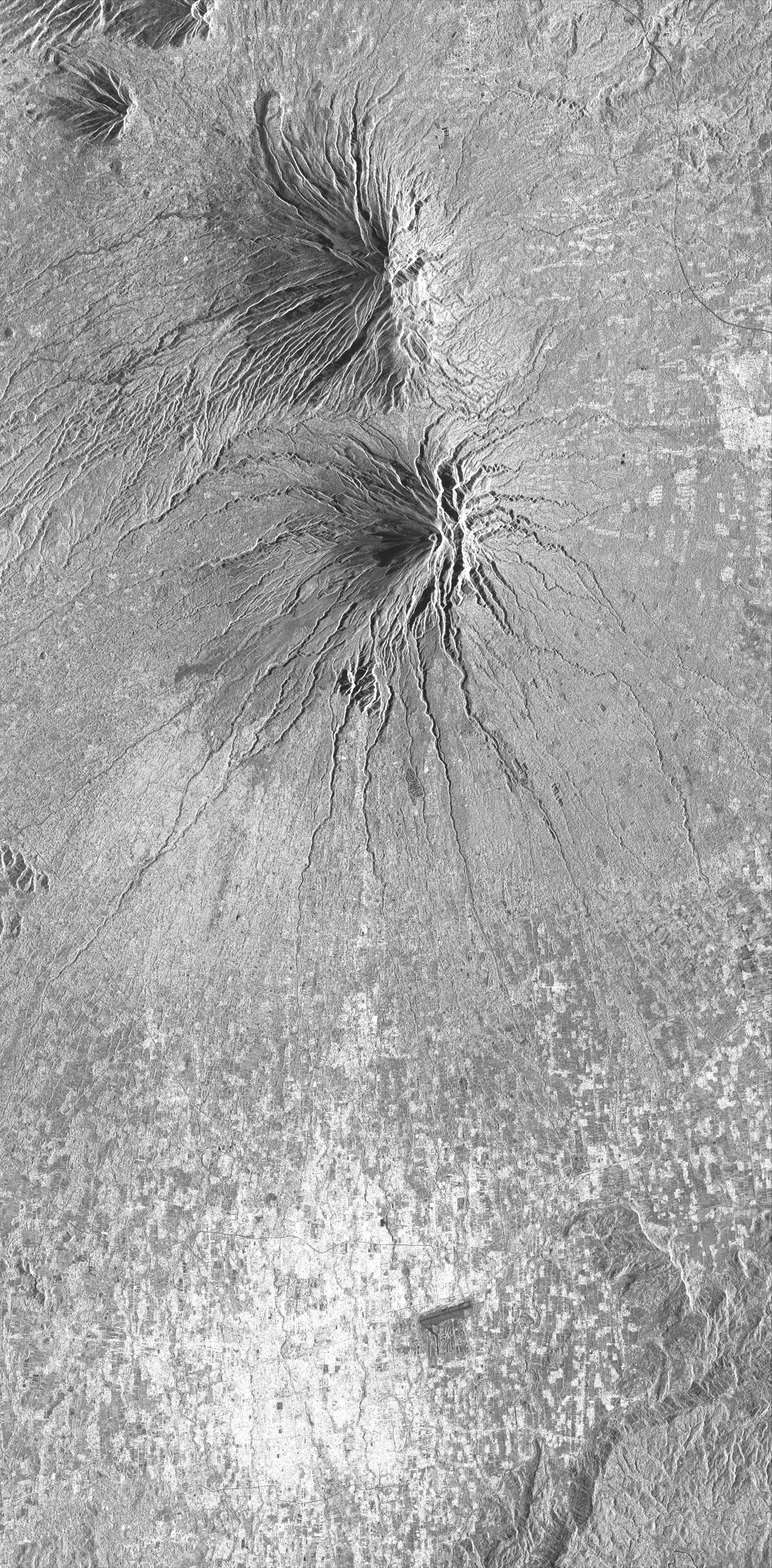
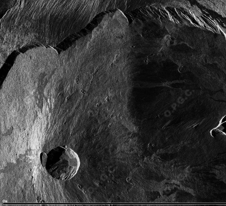
This collection includes radar images acquired by the sensor TerraSAR-X (monostatic) over Merapi volcano (Indonésie) in the framework of the projects DLR « Study of dome growth and summit topographic changes at andesitic strato-volcanoes» (OTHER6947) and « Tracking of dome growth at Merapi volcano, Indonesia » (XTIGEOL7375) . The data format is SSC (Single Look Slant Range Complex). The acquisition mode is stripMap (SM) for two ascending track A20 and A96 and one descending track D134.
-
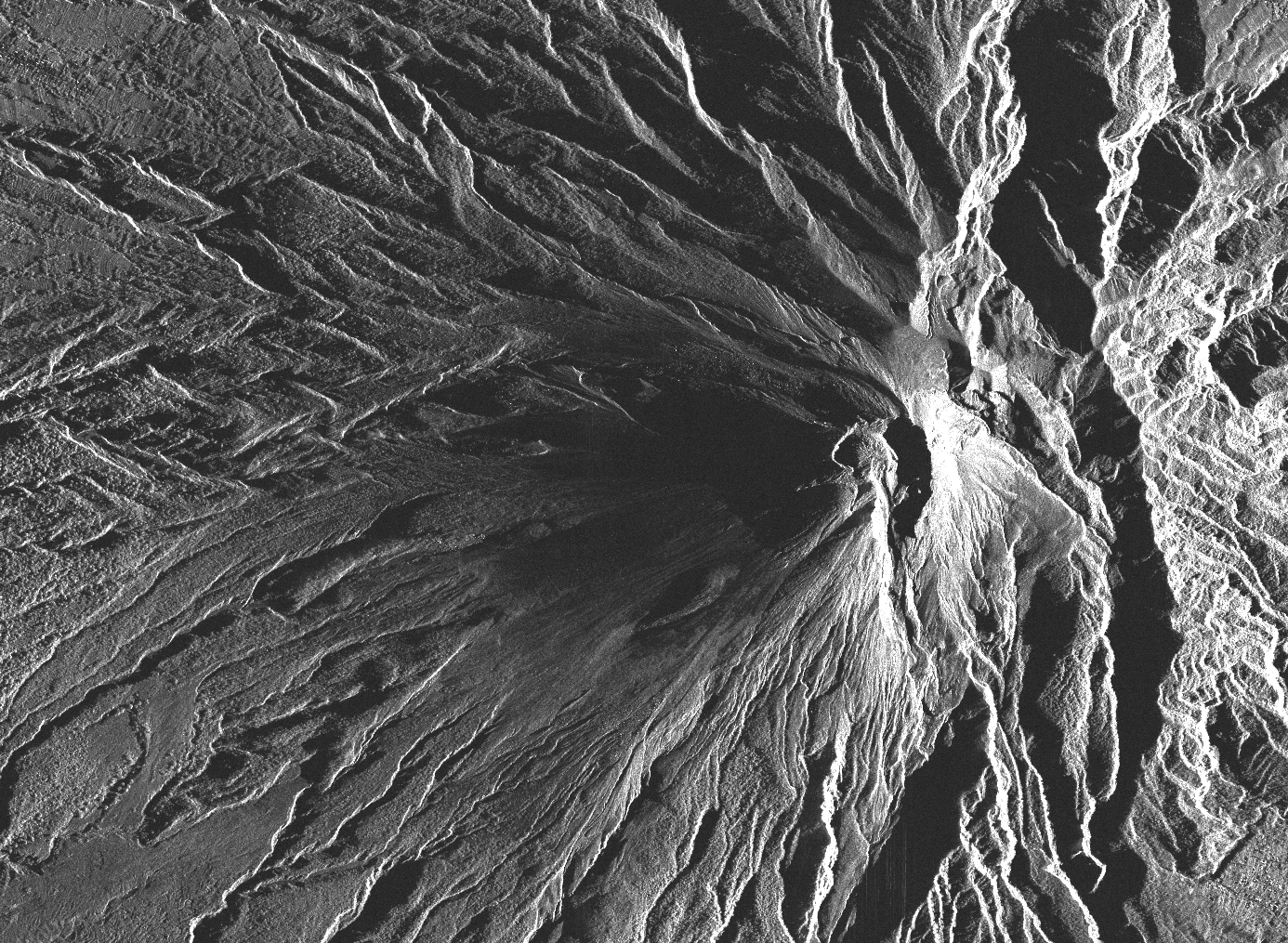
This collection includes radar images acquired by the sensor PAZ (monostatic) over Merapi volcano (Indonésie) in the framework of the project (AO-003-022) «Characterization of erupted volumes and ground deformation signals over Indonesian active volcanoes ». The data format is SSC (Single Look Slant Range Complex) with the acquisition mode High-resolution SpotLight (HS) for the descending tracks D020 and D111.
-
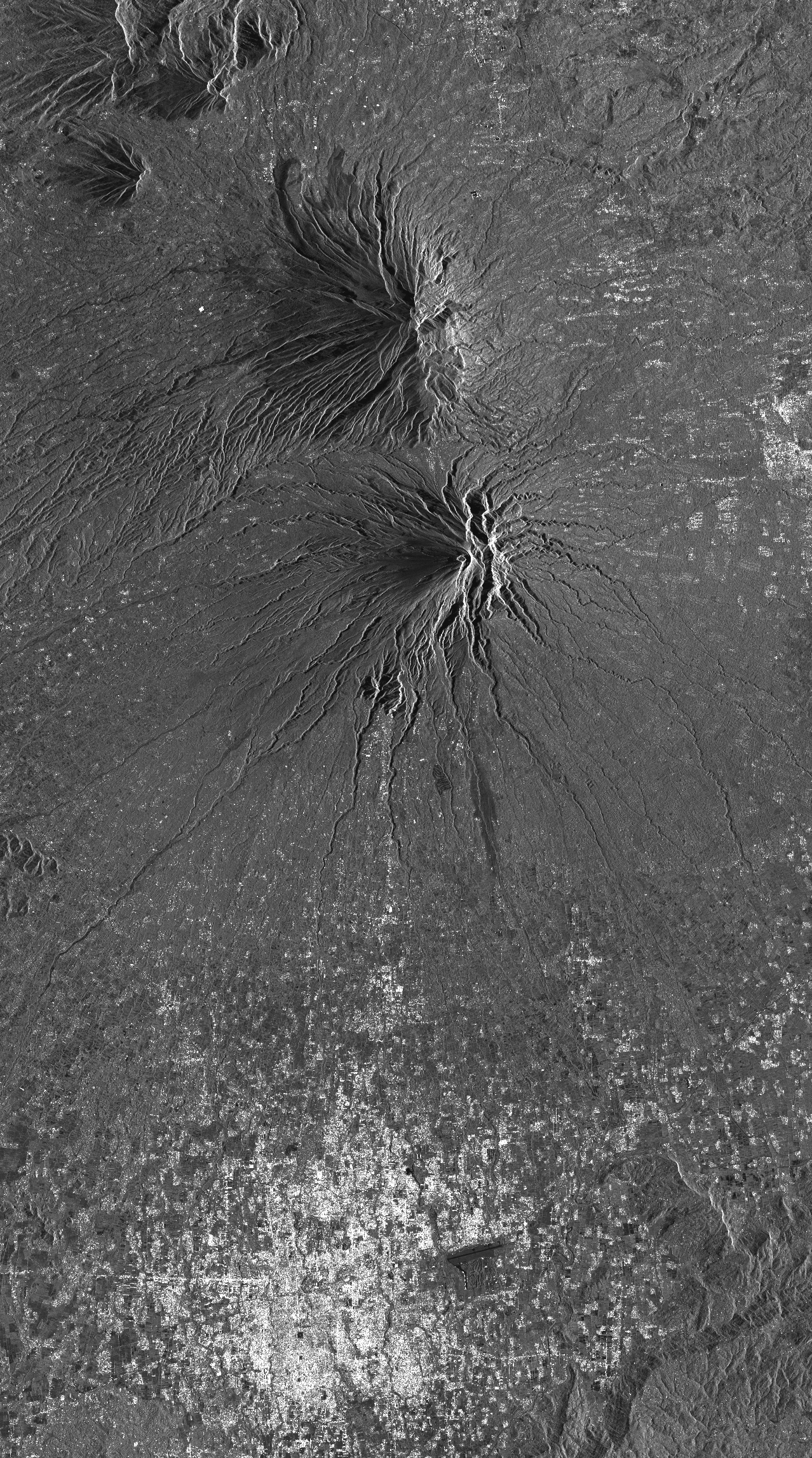
This collection includes radar images acquired by the sensor TerraSAR-X (monostatic) over Merapi volcano (Indonésie) in the framework of the project DLR (GEO1598) « Study of andesitic strato-volcanoes topographic changes and deformation through high-resolution SAR imagery ». The data format is SSC (Single Look Slant Range Complex). There are two acquisition modes: - mode StripMap (SM) for ascending track A20 and descending track D134. - mode SpotLight (SL) for ascending track A96 and descending track D58.
-
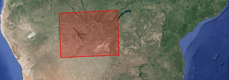
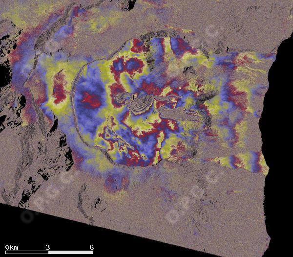
This project aims to better understand the deformations of tectonic origin in the area of the Okavango Delta (associated with the functioning of the Okavango rift and the East African rift), or of hydrological origin (linked in particular to the flood cycle. ), and the possible interactions between tectonics and hydrology in this region. Three types of products are made available for each orbit portion processed (see <a href="https://formater.pages.in2p3.fr/flatsim/" target="_blank"> detailed description </a> ) - "INTERFEROGRAM": this brings together the differential interferograms, wound and unwound, in radar or terrain geometry, filtered or not, at different resolutions, as well as the atmospheric correction maps used and spatial coherence for each interferogram. - "TIMESERIES": this includes maps of movement in time series and average speed, according to the satellite line of sight (LOS), and quality indices of time series processing. - "AUXILIARYDATA": this directory contains maps indicating the LOS vector, the DTM in radar geometry, at different resolutions, the radar-field geometry transcoding tables, and temporal coherence, as well as a set of figures and parameter files specific to the processing of the time series.
-
BD content description