 FormaTerre
Type of resources
Available actions
Topics
Keywords
Contact for the resource
Provided by
Years
Formats
Representation types
Update frequencies
status
-

The aim of the GeORG project (Geopotentials of the deep Upper Rhine Graben, https://www.geopotenziale.org/home/index_html) was to create a 3D model of the geological structure of the Upper Rhine Graben down to a depth of several kilometers. The project began in October 2008 and ended in December 2012. GeORG offers a complete geoscientific information base. Maps showing the deep structure and spatial distribution of geological layers and temperatures have been extracted. Geological cross-sections can be generated over the entire study area and in all directions. These show the stratigraphic position and stacking of layers in space. GeORG has created an information access platform for companies, public and private project developers and research organizations. The results are accessible to all at https://maps.geopotenziale.eu. Several products from the GeORG mapviewer around Soutz-sous-Forêts geothermal site are extracted.
-

The aim of the GeORG project (Geopotentials of the deep Upper Rhine Graben, https://www.geopotenziale.org/home/index_html) was to create a 3D model of the geological structure of the Upper Rhine Graben down to a depth of several kilometers. The project began in October 2008 and ended in December 2012. GeORG offers a complete geoscientific information base. Maps showing the deep structure and spatial distribution of geological layers and temperatures have been extracted. Geological cross-sections can be generated over the entire study area and in all directions. These show the stratigraphic position and stacking of layers in space. GeORG has created an information access platform for companies, public and private project developers and research organizations. The results are accessible to all at https://maps.geopotenziale.eu. Several products from the GeORG mapviewer around Vendenheim geothermal site are extracted.
-
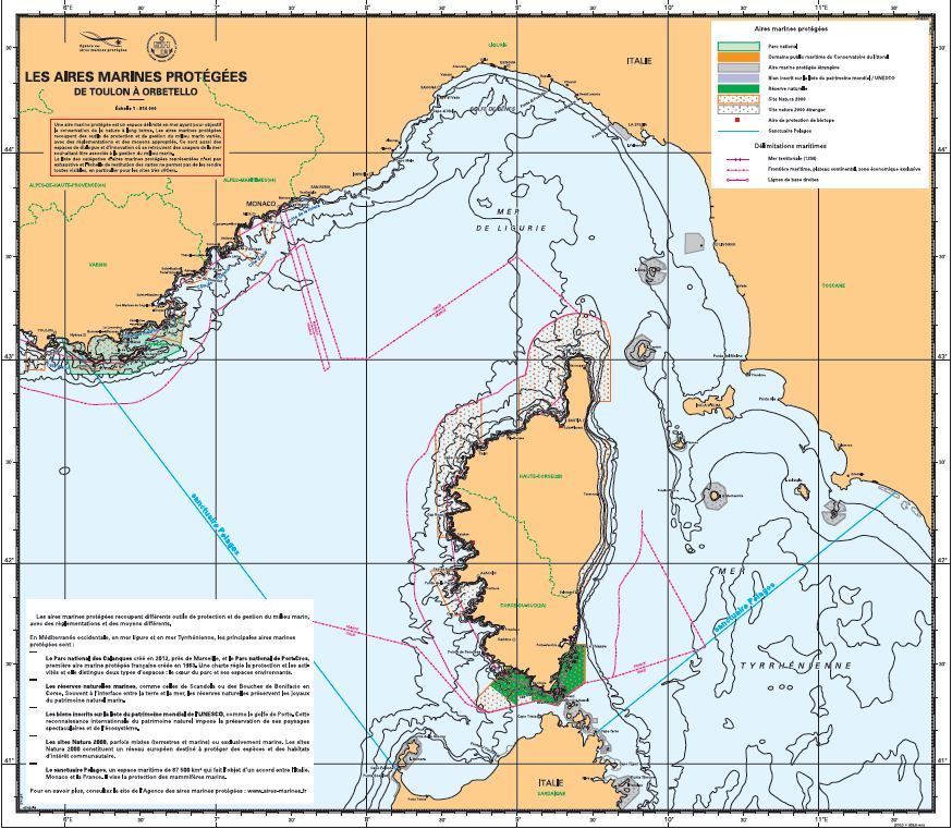
The maps show the network of protected marine areas (AMP) in mainland France, used to inform users of sea conditions and to inform authorities via display boards in port offices or any other public location. A protected marine area is a defined area at sea intended to protect the natural environment on a long-term basis. The list of protected marine areas is not exhaustive and not all such areas are visible due to the chart scale.