GRACE Earh Gravity Field Level 2 Collection
The GRACE level-2 products are the main outputs from the GRACE and GRACE-FO missions. They consist of the time average (10-day, monthly) solutions of the Earth gravity field in spherical harmonics.
GRACE is a joint project between the National Aeronautics and Space Administration ( NASA ) and the Deutsches Zentrum für Luft- und Raumfahrt ( DLR ). The mission has been proposed in 1996 jointly by the University of Texas at Austin, Center for Space Research ( UTCSR ), the German Research Centre for Geosciences ( GFZ ) and the Jet Propulsion Laboratories (JPL) in Pasadena. GRACE was selected in 1997 as second mission in NASA's Earth System Science Pathfinder ( ESSP ) program. As an innovation, the Principal Investigator Prof. Byron Tapley (UTCSR) and his team are ultimately responsible for developing the flight mission hardware from selection to a launch-ready condition, for accomplishing the scientific objectives and delivering the proposed measurements to the broader Earth science community and general public as expediently as possible. Co-Principal Investigator of the mission is Dr. Frank Flechtner (GFZ). Project management and systems engineering activities are carried out by JPL.
GRACE-FO is a joint project between the National Aeronautics and Space Administration ( NASA ) and the GeoForschungsZentrum ( GFZ ) Potsdam. GRACE-FO, launched May 22, 2018, is a successor to the original GRACE mission. The Principal Investigator at NASA JPL is Felix landerer. Co-Principal Investigator of the mission is Dr. Frank Flechtner (GFZ). Project management and systems engineering activities are carried out by JPL.
Simple
- Date (Revision)
- 2022-01-06
- Citation identifier
-
CNES:GRACE:RL05
- Purpose
-
The primary science objective of the GRACE and GRACE-FO missions is to measure the Earth’s gravity field and it’s time variability with unprecedented accuracy. The increase in accuracy has been achieved by utilizing two satellites following each other on the same orbital track. To consider precise attitude and non-gravitational forces both satellites are equipped with star cameras and accelerometers. The position and velocity of the satellites is measured using onboard GPS antennae and (for validation purposes) SLR retro-reflectors. Additionally, the twin satellites are interconnected by a K-band microwave link to measure the exact separation distance and its rate of change to an accuracy of better than 0.1 µm/s. These measurements are directly coupled to the seasonal and sub-seasonal variations in the continental hydrological cycle, to ice mass loss in the large glacier systems in Greenland or Antarctica, to long wavelength ocean circulation processes or to the transport of ocean heat to Earth’s poles. Additionally, GRACE provides the time variability of the Earth’ overall external shape, the geoid. Consequently, since its launch in March 2002 this fundamental dataset has enabled dramatic improvements of seasonal and inter-annual climate change estimates.
The secondary science objective of the GRACE and GRACE-FO missions is to obtain about 150 very precise globally distributed vertical temperature and humidity profiles of the atmosphere per day using the GPS radio occultation technique.
- Status
- On going
- Maintenance and update frequency
- As needed
- Keywords
-
-
Geodynamic
-
Gravitational field
-
- Use constraints
- Other restrictions
- Other constraints
-
Data is public, although an ISDC account is mandatory
- Spatial representation type
- Grid
- Distance
- 100 km
- Language
-
eng
- Character set
- UTF8
- Topic category
-
- Geoscientific information
))
- Begin date
- 2002-03-17
- Reference system identifier
- WGS 1984
- Distribution format
-
-
ASCII
(
)
-
ASCII
(
)
- OnLine resource
- Product description ( WWW:LINK-1.0-http--link )
- OnLine resource
-
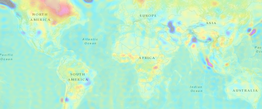
Average trend of the gravity signal
(
WTS
)
Gravity signal from GRACE and GRACE-FO (in Equivalent Water Heights), average trend
- OnLine resource
-
Average semiannual of the gravity signal
(
WTS
)
Gravity signal from GRACE and GRACE-FO (in Equivalent Water Heights)
- OnLine resource
-
Average annual of the gravity signal
(
WTS
)
Gravity signal from GRACE and GRACE-FO (in Equivalent Water Heights), average annual signal
- OnLine resource
- Product download ( WWW:LINK-1.0-http--link )
- OnLine resource
-
The Grace Plotter
(
WWW:LINK-1.0-http--link
)
Visualization service
- OnLine resource
- Cylindrical Gravity Anomalies ( WWW:LINK-1.0-http--link )
- OnLine resource
- Polar Gravity Anomalies ( WWW:LINK-1.0-http--link )
- OnLine resource
- Cylindrical Geoid Height Comparison ( WWW:LINK-1.0-http--link )
- OnLine resource
- Polar Geoid Height Comparison ( WWW:LINK-1.0-http--link )
- OnLine resource
- Cylindrical Water Heights Comparison ( WWW:LINK-1.0-http--link )
- OnLine resource
- Polar Water Heights Comparison ( WWW:LINK-1.0-http--link )
- Hierarchy level
- Series
Extent
- Statement
-
Based on the time-variable (monthly or 10-day) solutions CNES/GRGS RL04, a mean Earth gravity field model complete to degree and order 300 has been computed: EIGEN-GRGS.RL04.MEAN-FIELD.linear_mean_pole.zero_slope_extrapolation. It contains time-variable coefficients up to degree and order 90. For the higher degree part, it is based on a combined GRACE+GOCE static model: EIGEN-6C. This model has been used for Precise Orbit Determination of the altimetry satellites following the GDR-E standards
- File identifier
- e747d804-a5d1-4fd1-bd9b-306a8ebd4904 XML
- Metadata language
- Français
- Character set
- UTF8
- Hierarchy level
- Series
- Date stamp
- 2024-05-03T10:40:03
- Metadata standard name
-
ISO 19115:2003/19139
- Metadata standard version
-
1.0
Overviews
Spatial extent
Provided by
