Collection d’images TerraSAR-X sur la Montagne Pelée (Martinique)
TerraSAR-X image collection on Montagne Pelée (Martinique)
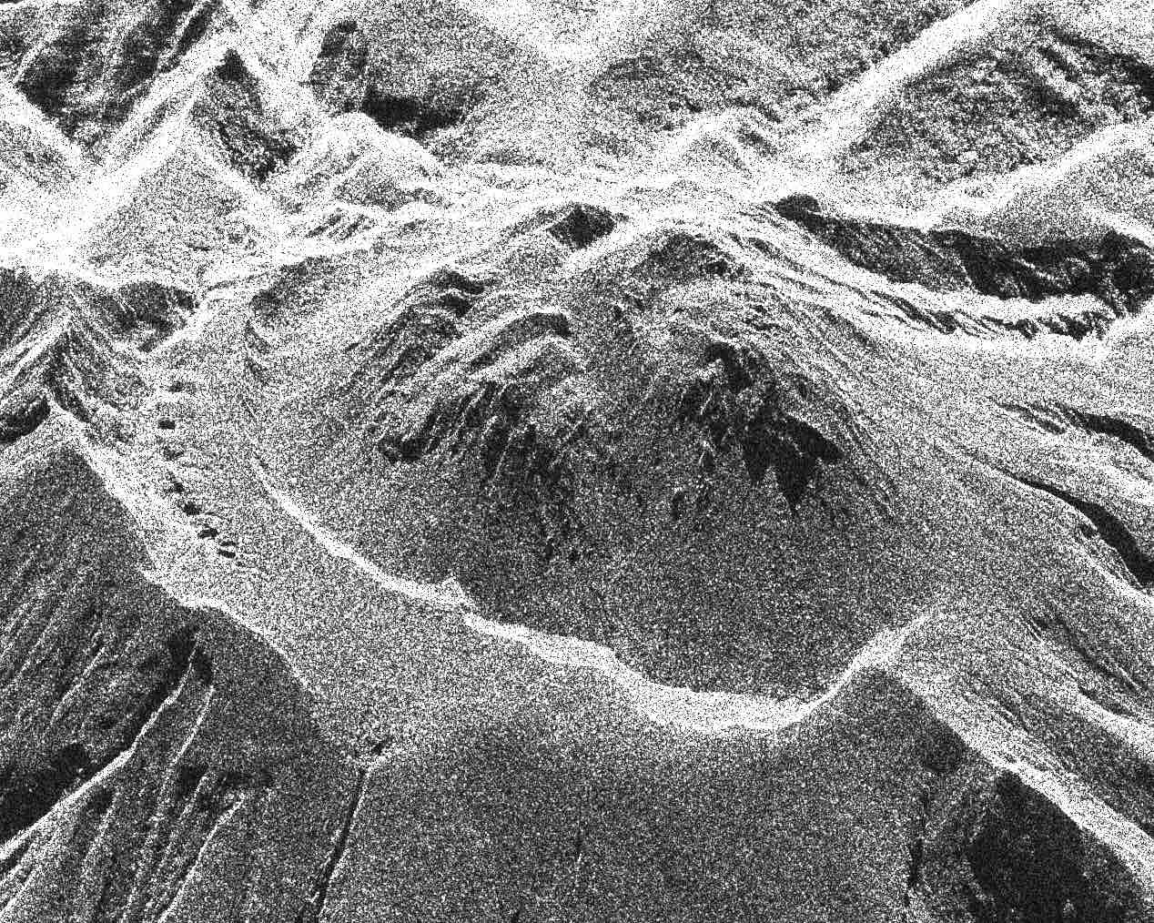
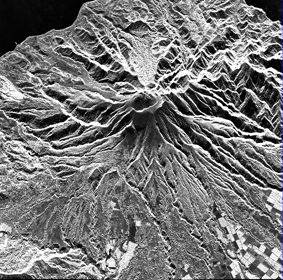
Cette collection rassemble les images radar acquises sur la constellation TerraSAR-X / TanDEM-X sur la Montagne Pelée (Martinique).
Les images sont au format SSC (Single Look Slant Range Complex).
Le mode d’acquisition est SPT (Spotlight) ou SM (Stripmap).
Les tracks sont o104 (track ascendante) ou o020 (track descendante).
This collection includes radar images acquired by the TerraSAR-X / TanDEM-X constellation over Montagne Pelée (Martinique).
Images are in SSC format (Single Look Slant Range Complex).
Acquisition mode is either SPT (Spotlight) or SM (Stripmap).
Tracks are either o104 (ascending track) or o020 (descending track).
Simple
-
Date (Revision)Date (Révision)
- 2022-07-13
-
Citation identifierIdentificateur
-
isdeform:martinique:terrasarx
-
StatusEtat
-
On goingMise à jour continue
-
Maintenance and update frequencyFréquence de mise à jour
-
As neededLorsque nécessaire
-
ThemeThème
-
-
Déformation du sol
Ground deformation
-
Image radar
Radar image
-
Radiométrie
Radiometry
-
-
locationlocation
-
-
La Martinique
La Martinique
-
-
Spatial representation typeType de représentation spatiale
-
GridRaster
-
DistanceDistance de résolution
- 2 m
- Language
-
eng
-
Character setEncodage des caractères
-
UTF8Utf8
-
Topic categoryCatégorie ISO
-
-
Geoscientific informationSciences de la terre, géosciences
-
))
))
- Begin date
- 2019-01-01
-
Reference system identifierNom du système de référence
- WGS 1984WGS 1984
-
Reference system identifierNom du système de référence
- ITRF
-
Distribution formatFormat (encodage)
-
-
tiftif
(
)
-
tiftif
(
)
-
Hierarchy levelNiveau
-
SeriesCollection de données
Extent
Etendue
-
File identifierIdentifiant de la fiche
- d8ecaa88-bd88-42cf-be73-142e0f55e467 XML
-
Metadata languageLangue
- Français
-
Character setJeu de caractères
-
UTF8Utf8
-
Hierarchy levelType de ressource
-
SeriesCollection de données
-
Date stampDate des métadonnées
- 2024-05-03T16:13:03
- Metadata standard name
-
ISO 19115:2003/19139
- Metadata standard version
-
1.0
Overviews
Spatial extent
Provided by
