Collection de MNS du service DSM-OPT
DSM collection of the service DSM-OPT
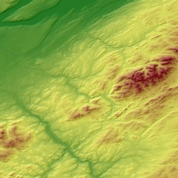
La collection se compose d'une série de produits (MNS, ombrages topographiques, cartes de qualité) d'intérêt pour la communauté des sciences de la Terre et de l'environnement. Il couvre divers sites et paysages à travers le monde.
Le jeu de données est une collection ouverte avec des mises à jour régulières en fonction de la disponibilité de l'imagerie stéréoscopique Pléiades à destination de la science et/ou des organismes publics et de la génération de produits topographiques avec le <a href=" https://www.poleterresolide.fr/le- service-dsm-opt/" target="_blank">Service à la demande DSM-OPT</a>.
La collection est diffusée selon les principes FAIR de la science ouverte avec l’identifiant numérique d’objet (DOI): doi:10.25577/0JGV-V947
The collection consists of a series of products (DSM, hillshades, quality maps) of interest for the Earth and environmental science community. It covers various sites and landscapes over the World. The dataset is an open collection with regular updates according to the availability of Pléiades stereo-imagery for science and/or public organizations and the generation of topographic products with the <a href=" https://www.poleterresolide.fr/le- service-dsm-opt/" target="_blank">DSM-OPT on-demand service</a> .
The collection is disseminated using FAIR principles under the Digital Object Identifier (DOI): doi:10.25577/0JGV-V947
Simple
-
Date (Revision)Date (Révision)
- 2024-06-09
-
Citation identifierIdentificateur
-
EOST-a2s:cat:DSM-OPT
-
ButPurpose
-
L'objectif est de faciliter l'accès aux modèles numériques de surface (MNS) VHR (0,5 m) représentant la topographie de la surface de la Terre (par exemple l'élévation) créés à partir d' <a href=" https://pleiades.cnes.fr/fr/observation-de- la-terre-satellites-pleiades-10-ans-deja" target="_blank">imagerie stéréoscopique satellite Pléiades</a>.
The target is to facilitate access to VHR (0.5m) Digital Surface Models (DSMs) representing the Earth surface topography (e.g. elevation) created from <a href=" https://pleiades.cnes.fr/fr/observation-de-la-terre-satellites-pleiades-10-ans-deja " target="_blank">Pléiades</a> satellite stereo-imagery.
-
StatusEtat
-
On goingMise à jour continue
-
Maintenance and update frequencyFréquence de mise à jour
-
As neededLorsque nécessaire
-
ThemeThème
-
-
Topographie Haute Résolution
High resolution topography
-
MNS / Modèles Numériques de Surface
DSM / Digital Surface Models
-
Satellite stéréoscopique
Stereoscopic satellite
-
-
Access constraintsContraintes d'accès
-
Other restrictionsAutres restrictions
-
Use constraintsContraintes d'utilisation
-
Other restrictionsAutres restrictions
-
Use constraintsContraintes d'utilisation
-
LicenseLicence
-
Autres contraintesOther constraints
-
Toute publication utilisant un DSM de la collection DSM-OPT doit inclure une référence au service à la demande DSM-OPT de l’IR Data-Terra. Par exemple, en français : « Cette publication est basée sur le service Web à la demande DSM-OPT développé et exploité par FormaTerre, le centre de données sur la Terre solide de l'infrastructure de recherche Data-Terra.doi:10.25577/0JGV-V947. »
Any publication using a DSM from the DSM-OPT collection must include a reference to the DSM-OPT on-demand service of the Data-Terra RI. For example, in English: “This publication is based on the DSM-OPT on-demand webservice developed and operated by FormaTerre, the Solid Earth data hub of the Data Terra Research Infrastructure. doi:10.25577/0JGV-V947.“
-
Autres contraintesOther constraints
-
Spatial representation typeType de représentation spatiale
-
GridRaster
-
DistanceDistance de résolution
- 0.5 m
-
DistanceDistance de résolution
- 2 m
- Language
-
eng
-
Character setEncodage des caractères
-
UTF8Utf8
-
Topic categoryCatégorie ISO
-
-
Geoscientific informationSciences de la terre, géosciences
-
))
- Begin date
- 2011-10-01
-
Reference system identifierNom du système de référence
- WGS 1984WGS 1984
-
Distribution formatFormat (encodage)
-
-
TIFFTIFF
(
)
-
TIFFTIFF
(
)
-
OnLine resourceRessource en ligne
- Service DSM-OPTDSM-OPT Service ( WWW:LINK-1.0-http--link )
-
OnLine resourceRessource en ligne
- Catalogue A2SA2S Catalog ( WWW:LINK-1.0-http--link )
-
OnLine resourceRessource en ligne
-
API opensearch TerradueAPI opensearch Terradue
(
OpenSearch
)
search=free;view=free;download=auth
search=free;view=free;download=auth
-
OnLine resourceRessource en ligne
- doi:10.25577/0JGV-V947doi:10.25577/0JGV-V947 ( DOI )
-
Hierarchy levelNiveau
-
SeriesCollection de données
Extent
Etendue
-
Généralités sur la provenanceStatement
-
La collection DSM-OPT est une initiative de l'Agence Spatiale Française / <a href=" https://cnes.fr/ " target="_blank">Centre National des Études Spatiales /CNES</a> et de l'Institut National des Sciences de l'Univers / <a href=" https://www.cnrs.fr " target="_blank">CNRS-INSU</a> à travers l'Infrastructure de Recherche (IR) Data-Terra et les pôles de données et services pour la Terre Solide - <a href=" https://www.poleterresolide.fr " target="_blank">FormaTerre</a>, pour les Surfaces Continentales - <a href=" https://www.theia-land.fr/ " target="_blank ">THEIA</a> et le Dipositif Institutionnel National français d'Accès Mutualisé en imagerie satellitaire Très Haute Résolution (VHR) – <a href=" https://dinamis.data-terra.org/ " target="_blank"> DINAMIS</a>.
The DSM-OPT collection is an initiative of the French Space Agency / <a href=" https://cnes.fr/ " target="_blank">CNES</a> and of Institut National des Sciences de l'Univers / <a href=" https://www.cnrs.fr " target="_blank">CNRS-INSU</a> through the Data-Terra Research Infrastructure (RI) and the Solid Earth Data Hub - <a href=" https://www.poleterresolide.fr " target="_blank">FormaTerre</a>, the Continental Surfaces Data Hub - <a href=" https://www.theia-land.fr/ " target="_blank">THEIA</a> and the French national facility for institutional procurement of Very-High Resolution (VHR) satellite imagery – <a href=" https://dinamis.data-terra.org/ " target="_blank">DINAMIS</a>.
-
File identifierIdentifiant de la fiche
- c0306897-38d1-4275-8b02-d6fc3149e3a7 XML
-
Metadata languageLangue
- Français
-
Character setJeu de caractères
-
UTF8Utf8
-
Hierarchy levelType de ressource
-
SeriesCollection de données
-
Date stampDate des métadonnées
- 2024-07-02T21:57:15
- Metadata standard name
-
ISO 19115:2003/19139
- Metadata standard version
-
1.0
Overviews
Spatial extent
Provided by
