DSM collection of the service DSM-OPT
The collection consists of a series of products (DSM, hillshades, quality maps) of interest for the Earth and environmental science community. It covers various sites and landscapes over the World. The dataset is an open collection with regular updates according to the availability of Pléiades stereo-imagery for science and/or public organizations and the generation of topographic products with the <a href=" https://www.poleterresolide.fr/le- service-dsm-opt/" target="_blank">DSM-OPT on-demand service</a> .
The collection is disseminated using FAIR principles under the Digital Object Identifier (DOI): doi:10.25577/0JGV-V947
Simple
- Date (Revision)
- 2024-06-09
- Citation identifier
-
EOST-a2s:cat:DSM-OPT
- Purpose
-
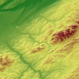
The target is to facilitate access to VHR (0.5m) Digital Surface Models (DSMs) representing the Earth surface topography (e.g. elevation) created from <a href=" https://pleiades.cnes.fr/fr/observation-de-la-terre-satellites-pleiades-10-ans-deja " target="_blank">Pléiades</a> satellite stereo-imagery.
- Status
- On going
- Maintenance and update frequency
- As needed
- Theme
-
-
High resolution topography
-
DSM / Digital Surface Models
-
Stereoscopic satellite
-
- Access constraints
- Other restrictions
- Use constraints
- Other restrictions
- Use constraints
- License
- Other constraints
-
Any publication using a DSM from the DSM-OPT collection must include a reference to the DSM-OPT on-demand service of the Data-Terra RI. For example, in English: “This publication is based on the DSM-OPT on-demand webservice developed and operated by FormaTerre, the Solid Earth data hub of the Data Terra Research Infrastructure. doi:10.25577/0JGV-V947.“
- Other constraints
- Spatial representation type
- Grid
- Distance
- 0.5 m
- Distance
- 2 m
- Language
-
eng
- Character set
- UTF8
- Topic category
-
- Geoscientific information
))
- Begin date
- 2011-10-01
- Reference system identifier
- WGS 1984
- Distribution format
-
-
TIFF
(
)
-
TIFF
(
)
- OnLine resource
- DSM-OPT Service ( WWW:LINK-1.0-http--link )
- OnLine resource
- A2S Catalog ( WWW:LINK-1.0-http--link )
- OnLine resource
-
API opensearch Terradue
(
OpenSearch
)
search=free;view=free;download=auth
- OnLine resource
- doi:10.25577/0JGV-V947 ( DOI )
- Hierarchy level
- Series
Extent
- Statement
-
The DSM-OPT collection is an initiative of the French Space Agency / <a href=" https://cnes.fr/ " target="_blank">CNES</a> and of Institut National des Sciences de l'Univers / <a href=" https://www.cnrs.fr " target="_blank">CNRS-INSU</a> through the Data-Terra Research Infrastructure (RI) and the Solid Earth Data Hub - <a href=" https://www.poleterresolide.fr " target="_blank">FormaTerre</a>, the Continental Surfaces Data Hub - <a href=" https://www.theia-land.fr/ " target="_blank">THEIA</a> and the French national facility for institutional procurement of Very-High Resolution (VHR) satellite imagery – <a href=" https://dinamis.data-terra.org/ " target="_blank">DINAMIS</a>.
- File identifier
- c0306897-38d1-4275-8b02-d6fc3149e3a7 XML
- Metadata language
- Français
- Character set
- UTF8
- Hierarchy level
- Series
- Date stamp
- 2024-07-02T21:57:15
- Metadata standard name
-
ISO 19115:2003/19139
- Metadata standard version
-
1.0
Overviews
Spatial extent
Provided by
