Collection images PAZ sur le Merapi
PAZ image collection on Merapi
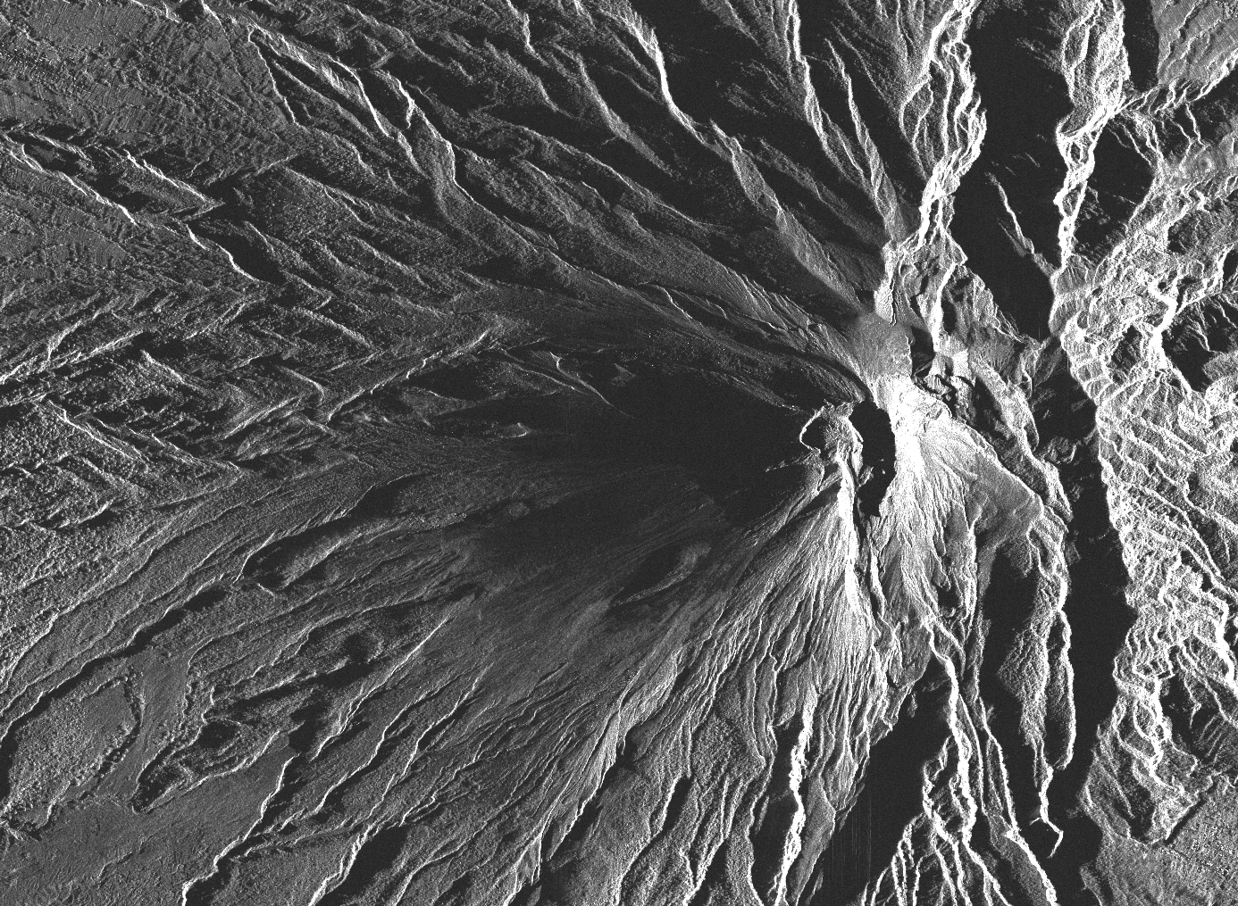
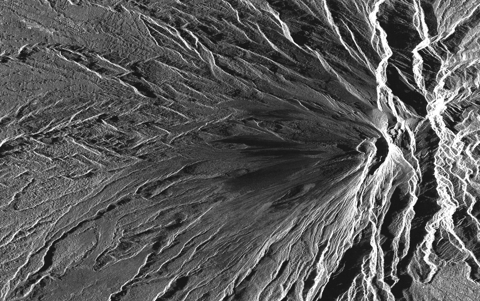
Cette collection comprend l'ensemble des images radar PAZ (monostatic) acquises sur le volcan Merapi (Indonésie) dans le cadre de du projet (AO-003-022) «Characterization of erupted volumes and ground deformation signals over Indonesian active volcanoes ». Les données sont au format SSC (Single Look Slant Range Complex) avec le mode d'acquisition High-resolution SpotLight (HS) pour les tracks descendantes D020 et D111.
This collection includes radar images acquired by the sensor PAZ (monostatic) over Merapi volcano (Indonésie) in the framework of the project (AO-003-022) «Characterization of erupted volumes and ground deformation signals over Indonesian active volcanoes ». The data format is SSC (Single Look Slant Range Complex) with the acquisition mode High-resolution SpotLight (HS) for the descending tracks D020 and D111.
Simple
-
Date (Revision)Date (Révision)
- 2023-12-06
-
Citation identifierIdentificateur
-
isdeform:merapi:paz
-
StatusEtat
-
Under developmentEn cours de création
-
Maintenance and update frequencyFréquence de mise à jour
-
As neededLorsque nécessaire
- Keywords
-
-
Déformation du sol
Ground deformation
-
Image radar
Radar image
-
Radiométrie
Radiometry
-
PAZ
PAZ
-
-
Spatial representation typeType de représentation spatiale
-
GridRaster
-
DistanceDistance de résolution
- 2 m
- Language
-
eng
-
Character setEncodage des caractères
-
UTF8Utf8
-
Topic categoryCatégorie ISO
-
-
Geoscientific informationSciences de la terre, géosciences
-
))
- Begin date
- 2022-03-01
-
Reference system identifierNom du système de référence
- WGS 1984WGS 1984
-
Reference system identifierNom du système de référence
- ITRF
-
Distribution formatFormat (encodage)
-
-
tiftif
(
)
-
tiftif
(
)
-
Hierarchy levelNiveau
-
SeriesCollection de données
Extent
Etendue
-
File identifierIdentifiant de la fiche
- 8bd43403-61f5-4888-9dfa-aa6b0f55a36f XML
-
Metadata languageLangue
- Français
-
Character setJeu de caractères
-
UTF8Utf8
-
Hierarchy levelType de ressource
-
SeriesCollection de données
-
Date stampDate des métadonnées
- 2024-05-03T16:13:55
- Metadata standard name
-
ISO 19115:2003/19139
- Metadata standard version
-
1.0
Overviews
Spatial extent
Provided by
