Collection d'interférogrammes et séries temporelles Sentinel-1 sur l'Hymalaya et l'ouest Tibet 2014-2022
Interferograms and time series collection on Himalaya and western Tibet 2014-2022
Trois types de produits sont mis à disposition pour chaque portion d’orbite traitée (voir la <a href=" https://formater.pages.in2p3.fr/flatsim/ " target="_blank">description détaillée</a>)
- « INTERFEROGRAM » : ensemble d'interférogrammes différentiels, enroulés et déroulés, en géométrie radar ou terrain, filtrés ou non, à différentes résolutions, ainsi que les cartes de corrections atmosphériques utilisées et de cohérence spatiale pour chaque interférogramme.
- « TIMESERIES » : répertoire incluant des cartes de déplacement en série temporelle et de vitesse moyenne, selon la ligne de visée du satellite (LOS), et des indices qualité du traitement en série temporelle.
- « AUXILIARYDATA » : ce repertoire contient des cartes indiquant le vecteur LOS, le MNT en géométrie radar, à différentes résolutions, les tables de transcodage géométrie radar-terrain, et la cohérence temporelle, ainsi qu’un ensemble de figures et fichiers de paramètres spécifiques au traitement de la série temporelle.
Three types of products are made available for each orbit portion processed (see <a href=" https://formater.pages.in2p3.fr/flatsim/ " target="_blank"> detailed description </a> )
- "INTERFEROGRAM": this brings together the differential interferograms, wound and unwound, in radar or terrain geometry, filtered or not, at different resolutions, as well as the atmospheric correction maps used and spatial coherence for each interferogram.
- "TIMESERIES": this includes maps of movement in time series and average speed, according to the satellite line of sight (LOS), and quality indices of time series processing.
- "AUXILIARYDATA": this directory contains maps indicating the LOS vector, the DTM in radar geometry, at different resolutions, the radar-field geometry transcoding tables, and temporal coherence, as well as a set of figures and parameter files specific to the processing of the time series.
Simple
-
Date (Revision)Date (Révision)
- 2021-04-15
-
Citation identifierIdentificateur
-
urn:ogc:def:EOP:CNES::TIBETHIM:
-
ButPurpose
-
Ce projet vient compléter le projet Tibet Est de l'AI FLATSIM 1, avec des objectifs variés de quantification des déformations tectoniques associées à la convergence Inde-Asie, depuis le front Himalayen et sur l'ensemble du plateau tibétain, de caractérisation de la rhéologie de la lithosphère et des processus hydrologiques, gravitaires, ou liés à la cryosphère. Les liens éventuels entre cycle sismique, forçages externes et construction des reliefs seront explorés. Des aspects plus méthodologiques comme le référencement quasi-absolu des mesures InSAR seront également abordés.
This project complements the East Tibet project of the 1st FLATSIM call, with the aim of quantifying the tectonic deformations associated with the India-Asia convergence, from the Himalayan front and across the Tibetan plateau, characterizing lithospheric rheology and hydrological, landslides and cryosphere-related processes. Possible links between the seismic cycle, external forcings and relief construction will be explored. More methodological aspects, such as the quasi-absolute referencing of InSAR measurements, will also be addressed.
-
StatusEtat
-
On goingMise à jour continue
-
Maintenance and update frequencyFréquence de mise à jour
-
As neededLorsque nécessaire
- Keywords
-
-
InSar
InSar
-
Déformation
Deformation
-
Interférogramme
interferogram
-
Aléa gravitaire
Landslides
-
Hydrologie
Hydrology
-
-
Access constraintsContraintes d'accès
-
RestrictedRestreint
-
Use constraintsContraintes d'utilisation
-
Other restrictionsAutres restrictions
-
Use constraintsContraintes d'utilisation
-
LicenseLicence
-
Autres contraintesOther constraints
-
Comment citer les produits: "FormaTerre (2020): FLATSIM Data Products. CNES. (Dataset), doi: https://www.doi.org/10.24400/253171/FLATSIM2020 "
How to cite: "FormaTerre (2020): FLATSIM Data Products. CNES. (Dataset), doi: https://www.doi.org/10.24400/253171/FLATSIM2020 "
-
Autres contraintesOther constraints
-
Autres contraintesOther constraints
-
Données FAIR, en phase de validation, accessibles uniquement à la communauté FormaTerre.
FAIR data, in validation phase, accessible only to the FormaTerre community
-
Spatial representation typeType de représentation spatiale
-
GridRaster
-
DistanceDistance de résolution
- 160 m
- Language
-
eng
-
Character setEncodage des caractères
-
UTF8Utf8
-
Topic categoryCatégorie ISO
-
-
Geoscientific informationSciences de la terre, géosciences
-
))
- Begin date
- 2014-10-01
- End date
- 2022-05-01
-
Reference system identifierNom du système de référence
- WGS 1984WGS 1984
-
Distribution formatFormat (encodage)
-
-
TIFFGEOTIFF
(
)
-
CSVCSV
(
)
-
TIFFGEOTIFF
(
)
-
OnLine resourceRessource en ligne
-
DOI 10.24400/253171/FLATSIM2020DOI 10.24400/253171/FLATSIM2020
(
WWW:LINK-1.0-http--link
)
Landing page produits FLATSIM doi:10.24400/253171/FLATSIM2020
-
OnLine resourceRessource en ligne
-
Thollard & al. 2021Thollard & al. 2021
(
WWW:LINK-1.0-http--related
)
Thollard, F., Clesse, D., Doin, M.-P., Donadieu, J., Durand, P., Grandin, R., Lasserre, C., Laurent, C., Deschamps-Ostanciaux, E, Pathier, E., Pointal, E, Proy, C., Specht, B. (2021). FLATSIM: The FormaTerre LArge-Scale Multi-Temporal Sentinel-1 InterferoMetry Service, Remote Sens. 13 (18), 3734. doi:10.3390/rs13183734
Thollard, F., Clesse, D., Doin, M.-P., Donadieu, J., Durand, P., Grandin, R., Lasserre, C., Laurent, C., Deschamps-Ostanciaux, E, Pathier, E., Pointal, E, Proy, C., Specht, B. (2021). FLATSIM: The FormaTerre LArge-Scale Multi-Temporal Sentinel-1 InterferoMetry Service, Remote Sens. 13 (18), 3734. doi:10.3390/rs13183734
-
OnLine resourceRessource en ligne
-
Grandin. 2015Grandin. 2015
(
WWW:LINK-1.0-http--related
)
Grandin R. (2015). Interferometric Processing of SLC Sentinel-1 TOPS Data. In Proceedings of FRINGE’15: Advances in the Science and Applications of SAR Interferometry and Sentinel-1 InSAR Workshop, Frascati, Italy, 23-27 March 2015, ESA Publication SP-731. doi:10.5270/Fringe2015.116
Grandin R. (2015). Interferometric Processing of SLC Sentinel-1 TOPS Data. In Proceedings of FRINGE’15: Advances in the Science and Applications of SAR Interferometry and Sentinel-1 InSAR Workshop, Frascati, Italy, 23-27 March 2015, ESA Publication SP-731. doi:10.5270/Fringe2015.116
-
OnLine resourceRessource en ligne
-
Doin & al. 2011Doin & al. 2011
(
WWW:LINK-1.0-http--related
)
Doin, M.-P., Lodge, F., Guillaso, S., Jolivet, R., Lasserre, C., Ducret, G., Grandin, R., Pathier, E., Pinel, V. (2011). Presentation of the small baseline NSBAS processing chain on a case example: The Etna deformation monitoring from 2003 to 2010 using Envisat data. In Proceedings of FRINGE 2011 ESA Workshop, Frascati, Italy,19–23 September 2011, ESA Publication SP-697.
Doin, M.-P., Lodge, F., Guillaso, S., Jolivet, R., Lasserre, C., Ducret, G., Grandin, R., Pathier, E., Pinel, V. (2011). Presentation of the small baseline NSBAS processing chain on a case example: The Etna deformation monitoring from 2003 to 2010 using Envisat data. In Proceedings of FRINGE 2011 ESA Workshop, Frascati, Italy,19–23 September 2011, ESA Publication SP-697.
-
OnLine resourceRessource en ligne
- Documentation ProduitsProduct documentation ( WWW:LINK-1.0-http--link )
-
OnLine resourceRessource en ligne
-
API opensearch FlatsimAPI opensearch Flatsim
(
OpenSearch
)
search=free;view=FLATSIM_TIBETHIM_V;download=FLATSIM_TIBETHIM_VD
search=free;view=FLATSIM_TIBETHIM_V;download=FLATSIM_TIBETHIM_VD
-
Hierarchy levelNiveau
-
SeriesCollection de données
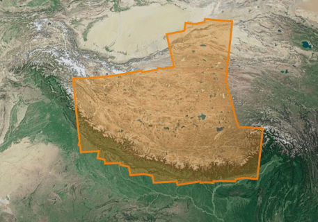
Extent
Etendue
-
Généralités sur la provenanceStatement
-
Ces collections d'interférogrammes et de séries temporelles de déplacement sont produites par le CNES dans le cadre du service FLATSIM. Ce service est développé en collaboration avec le pôle de Données et Services FormaTerre et les laboratoires ISTerre, LGL-TPE et IPGP. Les images radar utilisées proviennent de l’archive TOPSAR Sentinel-1 (données Copernicus). Les calculs sont faits à partir de la chaîne de traitement interférométrique NSBAS
These collections of interferograms and displacement time series are produced by CNES as part of the FLATSIM service. This service is developed in collaboration with the ForM @ Ter Data and Services pole and the ISTerre, LGL-TPE and IPGP laboratories. The radar images used come from the TOPSAR Sentinel-1 archive (Copernicus data). The calculations are made from the NSBAS interferometric processing chain
-
File identifierIdentifiant de la fiche
- 45808b4c-e380-4b1d-96cb-25803539183e XML
-
Metadata languageLangue
- Français
-
Character setJeu de caractères
-
UTF8Utf8
-
Hierarchy levelType de ressource
-
SeriesCollection de données
-
Date stampDate des métadonnées
- 2024-05-03T16:15:48
- Metadata standard name
-
ISO 19115:2003/19139
- Metadata standard version
-
1.0
Overviews
Spatial extent
Provided by
