Collection images TerraSAR-X sur le Merapi
TerraSAR-X image collection on Merapi
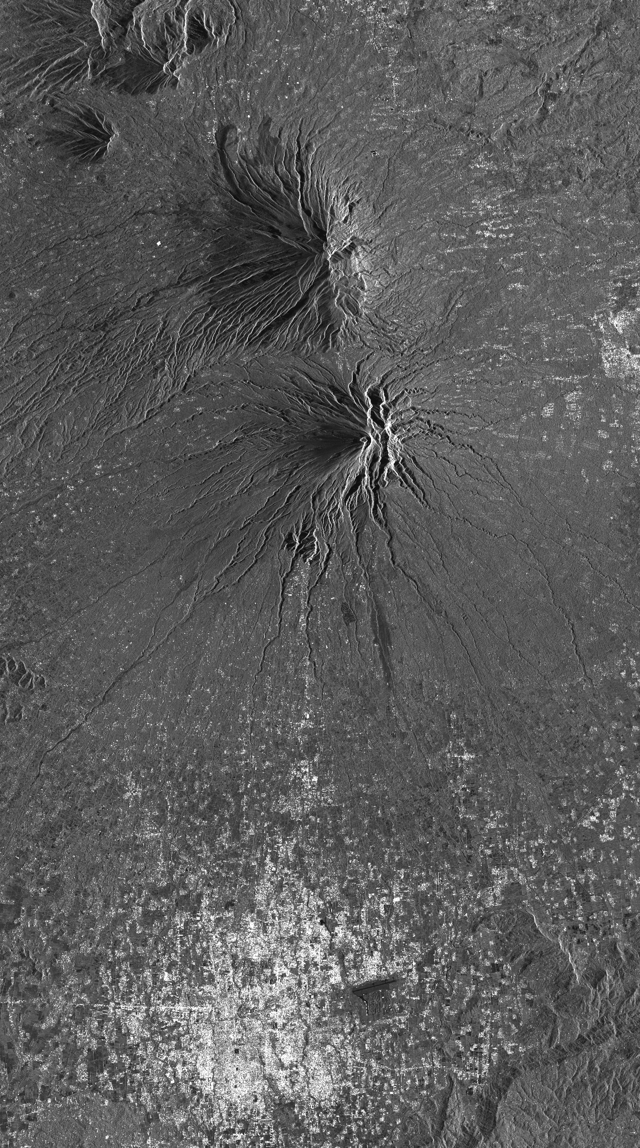
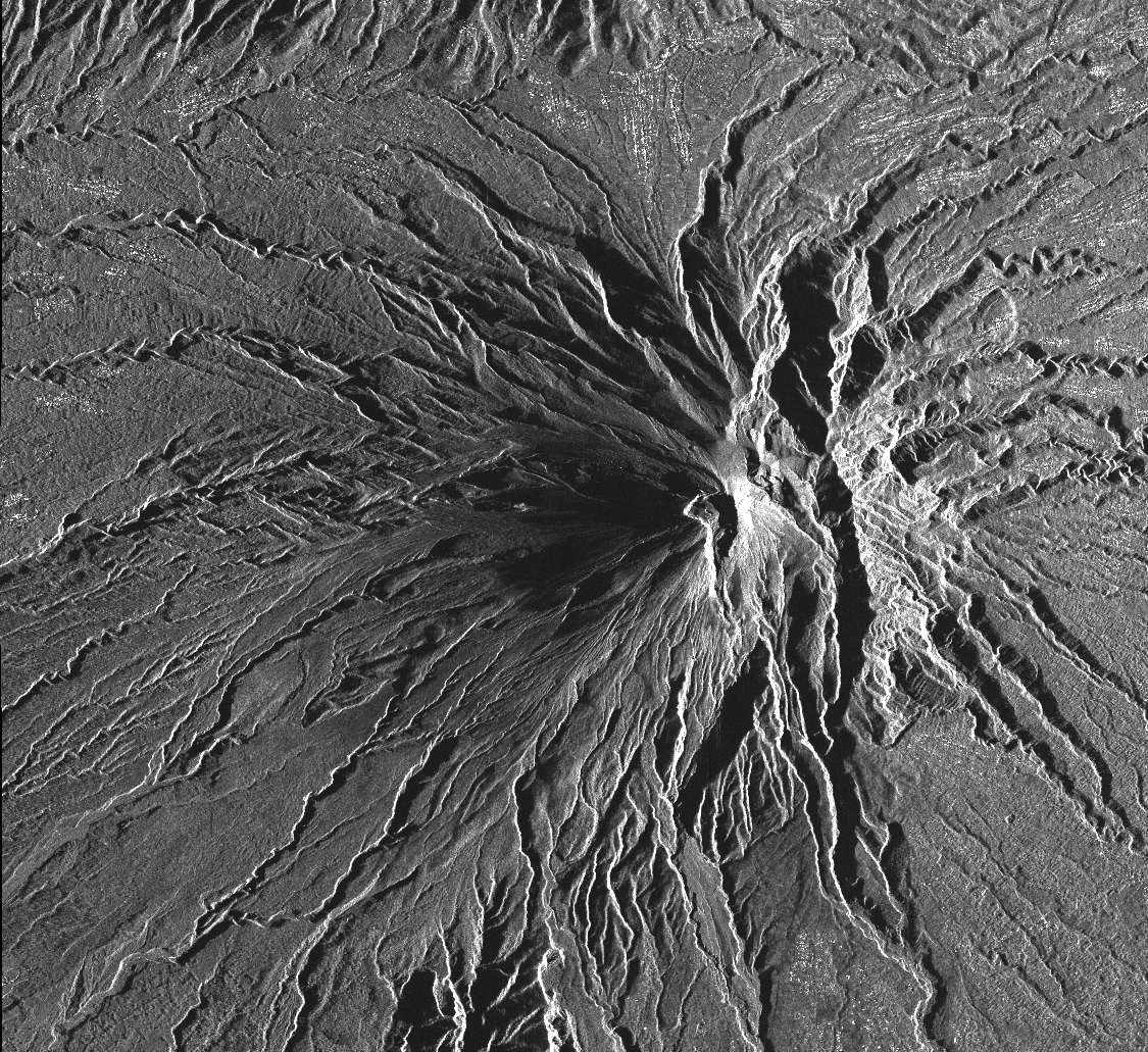
Cette collection comprend l'ensemble des images radar TerraSAR-X (monostatic) acquises sur le volcan Merapi (Indonésie) dans le cadre de l'AO DLR (GEO1598) « Study of andesitic strato-volcanoes topographic changes and deformation through high-resolution SAR imagery ». Les données sont au format SSC (Single Look Slant Range Complex).
Il existe deux modes d'acquisition:
- mode StripMap (SM) pour la track ascendante A20 et descendante D134.
- mode SpotLight (SL) pour la track ascendante A96 et descendante D58.
This collection includes radar images acquired by the sensor TerraSAR-X (monostatic) over Merapi volcano (Indonésie) in the framework of the project DLR (GEO1598) « Study of andesitic strato-volcanoes topographic changes and deformation through high-resolution SAR imagery ». The data format is SSC (Single Look Slant Range Complex).
There are two acquisition modes:
- mode StripMap (SM) for ascending track A20 and descending track D134.
- mode SpotLight (SL) for ascending track A96 and descending track D58.
Simple
-
Date (Revision)Date (Révision)
- 2023-12-06
-
Citation identifierIdentificateur
-
isdeform:merapi:terrasar-x
-
StatusEtat
-
Under developmentEn cours de création
-
Maintenance and update frequencyFréquence de mise à jour
-
As neededLorsque nécessaire
-
ThemeThème
-
-
Déformation du sol
Ground deformation
-
Image radar
Radar image
-
Radiométrie
Radiometry
-
-
Spatial representation typeType de représentation spatiale
-
GridRaster
-
DistanceDistance de résolution
- 2 m
- Language
-
eng
-
Character setEncodage des caractères
-
UTF8Utf8
-
Topic categoryCatégorie ISO
-
-
Geoscientific informationSciences de la terre, géosciences
-
))
- Begin date
- 2010-10-30
-
Reference system identifierNom du système de référence
- WGS 1984WGS 1984
-
Reference system identifierNom du système de référence
- ITRF
-
Distribution formatFormat (encodage)
-
-
tiftif
(
)
-
tiftif
(
)
-
Hierarchy levelNiveau
-
SeriesCollection de données
Extent
Etendue
-
File identifierIdentifiant de la fiche
- 13437a69-e7e9-411a-92ef-ac5f2d5091ad XML
-
Metadata languageLangue
- Français
-
Character setJeu de caractères
-
UTF8Utf8
-
Hierarchy levelType de ressource
-
SeriesCollection de données
-
Date stampDate des métadonnées
- 2024-05-03T16:11:23
- Metadata standard name
-
ISO 19115:2003/19139
- Metadata standard version
-
1.0
Overviews
Spatial extent
Provided by
