 FormaTerre
NetCDF
Type of resources
Available actions
Topics
INSPIRE themes
Provided by
Formats
Representation types
Update frequencies
-
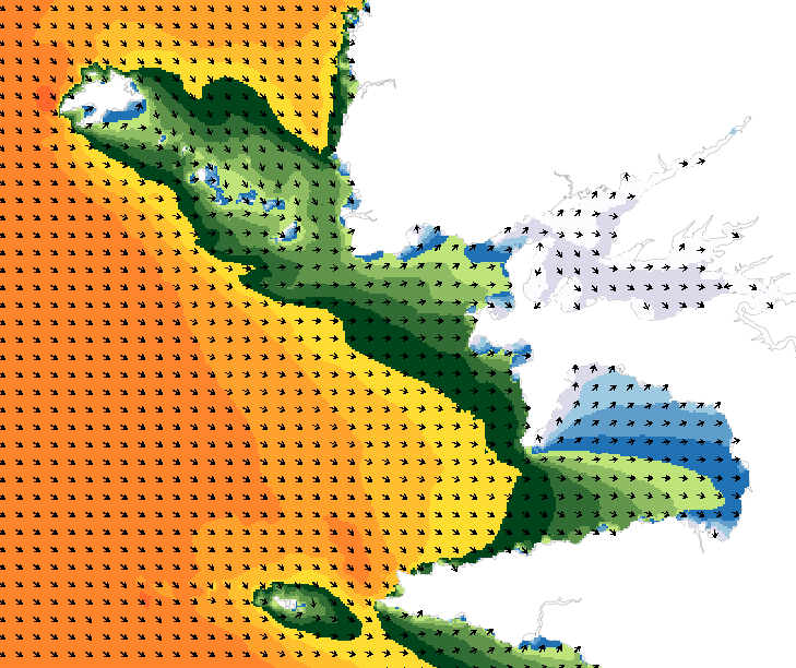
Wave forecasting models allow the representation of sea states based on a spectral resolution at the global scale or at the scale of ocean basins. This code calculates the evolution of the sea state by decomposing it into a wave spectrum that propagates in different directions and with different periods. During the propagation, the wave energy is increased or decreased by the effects of wind, breaking waves and energy exchanges between the different components. The wave forecasts available on data.shom.fr are calculated with 2 different types of models: MFWAM for the offshore domain (resolution from 0.5° to 0.1°) and Wavewatch III ® (WW3) for the coastal domain (resolution from 2' to 200m). MFWAM is a sea state forecasting model (wind wave and swell) derived from the third generation WAM code (WAMDI Group, 1988). Wavewatch III ® (WW3) is developed in a collaboration between the United States Weather Service (NOAA/NCEP), Shom, the University of Darmstadt in Germany, and other partners. The forecasts published on data.shom.fr are issued from the parameterization carried out and optimized by the Shom and Météo-France within the framework of the Homonim project (national coastal flood/wave/storm warning system).
-
Pour modéliser les niveaux d'eau (notamment la marée astronomique et les surcotes météorologiques), le Shom utilise une version barotrope (2D) du code HYCOM (https://hycom.org/) configuré sur 2 domaines : Atlantique et Méditerranée. Les configurations ont été paramétrisées avec une bathymétrie fine et une grille curviligne à résolution variable allant de 2km au large à 500m à la côte. Ces modèles ont été adaptés par le Shom à la modélisation des zones côtières par la prise en compte, notamment, de la marée et de la bathymétrie haute résolution en zone côtière (de 100m pour les MNT de façade à 20m pour les MNT littoraux) utilisant notamment les levés Litto3D par LIDAR aéroportés. Les modèles sont opérés par Météo-France et le Shom dans le cadre de la vigilance Vagues-Submersions.