 FormaTerre
High Resolution Coastline
The high resolution Coastline corresponds to the Highest Astronomical Tide (HAT) with a tidal coefficient of 120 and in normal weather conditions (no sea breeze and mean atmospheric pressure of 1013 hPa).
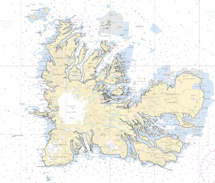
The high resolution coastline is available in french subantarctic islands (984).
Simple
- Date (Publication)
- 2021-10-18
- Citation identifier
- http://www.shom.fr/BDML/TCHR
- Credit
-
©Shom
- Theme
-
-
high resolution coastline
-
littoral
-
TCHR
-
product
-
open data
-
- Use limitation
-
Do not use for navigation
- Use limitation
-
The product is not designed for use at scales of more than 1:3 000 in mainland France and 1:20 000 in Kerguelen.
- Use limitation
-
The High Resolution Coastline file can be freely used in the integrated databases or services, under the following conditions:
- explicit mention of the source by indicating "©Shom 2016. http://dx.doi.org/10.17183/TCHR " when displayed,
- clear indication to the user of any restrictions which apply to data,
- website references must show the Shom logo and a link to the Shom website www.shom.fr.
- Use limitation
-
The high resolution coastline was not designed for use in the operation of nuclear facilities, air navigation or communications systems, navigation or air traffic control systems, or any other area referred to as "hazardous activities", where a failure of the product could result in death, personal injury or serious physical or environmental damage. In general, in metropolitan France the planimetric accuracy is better than 5 m (uncertainty of the source data, bathymetric lidar or OrtholittoralV2). On certain particular areas (absence of the two previous sources), as well as on all the archipelago of Kerguelen, the precision can reach a few tens of meters.
- Classification
- Unclassified
- Use limitation
-
The product is distributed under an Opendata license (version 2.0, April 2017), defined by the Etalab mission.
- Access constraints
- License
- Use constraints
- Other restrictions
- Other constraints
-
The High Resolution Coastline file can be freely used in the integrated databases or services, under the following conditions:
- explicit mention of the source by indicating "©Shom 2016. http://dx.doi.org/10.17183/TCHR " when displayed,
- clear indication to the user of any restrictions which apply to data,
- website references must show the Shom logo and a link to the Shom website www.shom.fr.
- Access constraints
- Other restrictions
- Other constraints
- No public access restrictions.
- Classification
- Unclassified
- Spatial representation type
- Vector
- Denominator
- 20000
- Language
- Français
- Character set
- UTF8
- Topic category
-
- Elevation
- Description
-
Îles subantarctiques françaises
))
- Distribution format
-
-
SHP
(
inapplicable
)
-
GML
(
3.2
)
-
SHP
(
inapplicable
)
- OnLine resource
-
Shom geoportal
(
WWW:LINK-1.0-http--link
)
Shom geoportal
- OnLine resource
- TCHR_3857_WMSV ( OGC Web Map Service )
- OnLine resource
- Download service french subantarctic islands ( WWW:DOWNLOAD-1.0-http--download )
- OnLine resource
- TCHR_3857_WFS:tchr_kerguelen_3857 ( OGC Web Feature Service )
- Hierarchy level
- Dataset
Conformance result
- Date (Publication)
- 2010-11-23
- Explanation
-
Information sur la conformité au règlement d'interopérabilité des séries et des services de données géographiques.
- Pass
- Yes
Conformance result
- Date (Publication)
- 2014-04-17
- Explanation
-
Information sur la conformité de la ressource à une spécification (INSPIRE).
- Pass
- Yes
- Statement
-
In french subantarctic islands, the high resolution coastline comes mainly from automatic or manual extraction.
- File identifier
- BDML_TCHR.xml XML
- Metadata language
- Français
- Character set
- UTF8
- Hierarchy level
- Dataset
- Hierarchy level name
-
Produit
- Date stamp
- 2021-10-21T17:10:15
- Metadata standard name
-
ISO 19115:2003/19139
- Metadata standard version
-
1.0
Overviews
Spatial extent
Provided by
